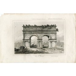
Antique map of France. Tardieu and Vuillemin (1863)
€85.00
Tax included
Map of France.
Title: Gaules
Media: engraving on a vellin type paper.
Provenance: 'Atlas Universel de Geographie ancienne et moderne', by A. Tardieu and A. Vuillemin for 'L'Intelligence de la Geographie Universelle de Malte-Brun LaVallee, Paris, 1863. (Transl.: World Atlas of old and modern geography by Tardieu and Vuillemin for the knowledge of geography of Malte-Brun.)
Artists and Engravers: The authors / cartographers are Ambroise Tardieu and A. Vuillemin. Ambroise Tardieu (Paris 1788-1841) was an eminent French cartographer and engraver, and is celebrated for his version of John Arrow Smith's 1806 map of the United States.
The maps are etched / engraved by Lemercier.
Image size: 43x34 cms.
Paper size: 51x41 cms.
Condition: One tear restaurated with tape on lower central margin. General age related toning. Foxing as visible on scan. Please study scan carefully.
")
")