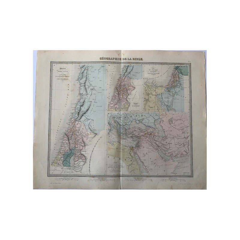


Original engraved map devoted to biblical geography, in four panels: Palestine or the Holy Land, the land of Canaan in the time of the patriarchs and the ancient Near East as a whole. Colored by hand in period outline. Published by Furne in Paris for the Atlas Universel de Geographie ancienne et moderne of Tardieu and Vuillemin.
Original engraved map devoted to biblical geography, in four panels: Palestine or the Holy Land, the land of Canaan in the time of the patriarchs and the ancient Near East as a whole. Colored by hand in period outline. Published by Furne in Paris for the Atlas Universel de Geographie ancienne et moderne of Tardieu and Vuillemin.
Medium: Copper engraving, hand-colored
Artist / after: Ambroise Tardieu (1788-1841) and Alexandre Vuillemin
Engraver: Lemercier workshop, Paris
Date: 1874
Source: Atlas Universel de Geographie ancienne et moderne, ed. Furne, Paris. Sheet no. 3
Dimensions: Image 16.9 x 13.4 in (43 x 34 cm); sheet 20.1 x 16.1 in (51 x 41 cm)
Condition: A cut in the lower central margin repaired with adhesive tape, central binding fold and toning consistent with age.
Original engraved map devoted to biblical geography, in four panels: Palestine or the Holy Land, the land of Canaan in the time of the patriarchs and the ancient Near East as a whole. Colored by hand in period outline. Published by Furne in Paris for the Atlas Universel de Geographie ancienne et moderne of Tardieu and Vuillemin.