Antique Maps

Subcategories
-

Maps of Spain
Antique Maps of Spain
Original maps and town plans of Spain from 1707 to 1937, most engraved by Pieter van der Aa and Isaac Basire: the fort of Montjuïc in Barcelona, the town of Flix on the Ebro, the bay of Cádiz and Rota, and a 1796 map of Spain and Portugal from Walker's New Atlas.
This is one of our largest sections, of interest to collectors of Spanish cartography, local historians and anyone wanting a period map of their own region or city. Each map is an original of its time, with a technical sheet giving scale, technique and measurements.
-

Maps of Europe
Antique Maps of Europe
A broad collection of original European maps from 1646 to 1939, from Pieter van der Aa's plans of Setúbal to hand-coloured 19th-century sheets by Johann Walch and Ramón Alabern, plus the Robert de Vaugondy-Delamarché atlas plates covering countries from Ireland to Italy.
This section suits collectors building a country-by-country map collection as well as anyone wanting a period view of a specific European region. Every map is an original of its time, with a technical sheet giving technique, date and exact measurements.
-

Maps of America
Antique Maps of the Americas
Original maps of the Americas from 1748 to 1885: Tardieu and Vuillemin's map of North America, Ramón Alabern's map of the Antilles and Cuba, Chedel's coloured plate of Santo Domingo for Bellin, and Madrid-printed lithographed maps of the United States and Central America.
A wide-ranging section for collectors of American historical cartography, from the colonial Caribbean to the 19th-century United States. Every map is an original of its time, with a technical sheet and exact measurements.
-
Maps of Asia
Antique Maps of Asia
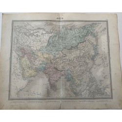
Original maps of Asia from 1814 to 1939: a general map of the continent by Tardieu and Vuillemin, a map of biblical Palestine, a 19th-century lithograph of the East Indies, Indochina and the Philippines, Ramón Alabern's map of Alexander's empire, and a 1939 map of Turkey, Syria, Iraq and Transjordan.
A wide-ranging category for collectors of Middle Eastern and East Asian cartography alike. Every map is an original of its time, with a technical sheet and exact measurements.
-

Maps of Africa
Antique Maps of Africa
Original maps of Africa from 1847 to 1898: Delamarche's hand-coloured 1847 map of the continent, an 1898 map published in La Ilustración Española y Americana, Ramón Alabern's map of Arabia, Egypt, Nubia and Abyssinia, and Robert de Vaugondy-Delamarché's plate of Congo and Kaffraria.
A wide-ranging category for collectors tracing how European cartographers depicted the continent through the 19th century, from early exploration to the eve of the colonial partition. Every map is an original of its time, with a technical sheet and exact measurements.
-

Maps of Oceania
Antique Maps of Oceania
Original maps of Oceania from 1874 to 1939: Tardieu's hand-coloured map of Oceania and Australia, a lithographed map from a Gras y Cía. atlas, Drioux and Leroy's physical and political map of the region, and a 1939 Madrid-printed map of Australia, New Zealand and Oceania by Salvador Salinas.
A compact but varied category for collectors of Pacific cartography, spanning six decades of changing print methods. Every map is an original of its time, with a technical sheet and exact measurements.
-

World Maps and...
Antique world maps and hemispheres
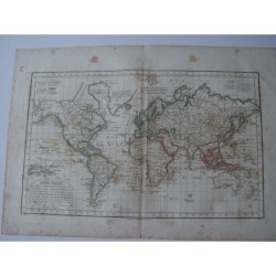
This selection brings together original double-hemisphere world maps and planispheres, engraved in the nineteenth century by cartographic publishers such as Tardieu-Vuillemin and Robert de Vaugondy-Delamarché. Several pieces date from 1858, printed in Paris by houses like Furne, and show the world as understood before the great polar expeditions closed the map.
These maps interest collectors of historical cartography and anyone furnishing a study or library with a striking, decorative wall piece. Every map offered here is an original period impression, not a modern reproduction, and comes with a technical description and measurements.
-

City Plans
Antique city plans
This category gathers original engraved city plans from the eighteenth and nineteenth centuries, many by the Dutch publisher Pieter van der Aa and the engraver Isaac Basire. They include plans of Spanish towns such as Madrid, Lérida, Puigcerdà and Flix, alongside sieges and fortifications like Alicante's castle in 1708, dated between 1707 and 1846.
City plans are prized by local historians, municipal collectors and anyone looking for a meaningful gift tied to a particular place. Each plan sold here is an authentic period print, accompanied by a full technical sheet and exact measurements.