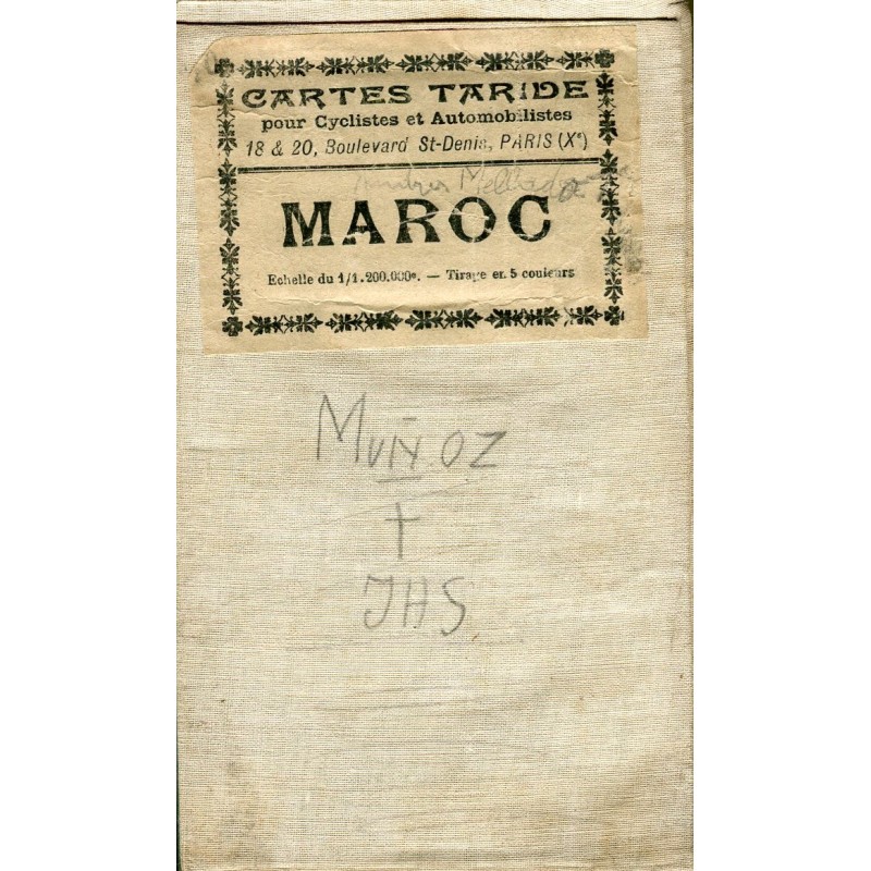


Antique linen-backed map of Morocco published in Paris by A. Taride, the publisher on Boulevard Saint-Denis, in his series "Cartes Taride pour cyclistes et automobilistes". Nouvelle Carte du Maroc, commerce, industrie, tourisme, at a scale of 1:1,200,000 and printed in five colors.
Antique linen-backed map of Morocco published in Paris by A. Taride, the publisher on Boulevard Saint-Denis, in his series "Cartes Taride pour cyclistes et automobilistes". Nouvelle Carte du Maroc, commerce, industrie, tourisme, at a scale of 1:1,200,000 and printed in five colors.
Printed on paper mounted on linen and folded in panels, with its original cloth covers and typographic label. It covers the whole country, from the Atlantic to the Mediterranean and the Rif, with relief, railways and roads picked out in red.
Medium: Five-color printing on linen-backed paper.
Source: A. Taride, publisher, 18 & 20 Boulevard Saint-Denis, Paris.
Date: No printed date; first third of the 20th century.
Dimensions: 31.5 x 37.4 in (80 x 95 cm) open.
Condition: Fair for its age. Foxing and toning natural to the paper, sharp folds; cloth covers soiled and with a former owner's manuscript notes ("Muñoz").
Antique linen-backed map of Morocco published in Paris by A. Taride, the publisher on Boulevard Saint-Denis, in his series "Cartes Taride pour cyclistes et automobilistes". Nouvelle Carte du Maroc, commerce, industrie, tourisme, at a scale of 1:1,200,000 and printed in five colors.