Maps of Spain
Antique Maps of Spain
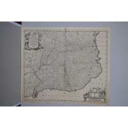
Original maps and town plans of Spain from 1707 to 1937, most engraved by Pieter van der Aa and Isaac Basire: the fort of Montjuïc in Barcelona, the town of Flix on the Ebro, the bay of Cádiz and Rota, and a 1796 map of Spain and Portugal from Walker's New Atlas.
This is one of our largest sections, of interest to collectors of Spanish cartography, local historians and anyone wanting a period map of their own region or city. Each map is an original of its time, with a technical sheet giving scale, technique and measurements.

Subcategories
-

Maps of Tarragona
Antique Maps of Tarragona
Original plans of Tarragona province from 1715 to 1744, chiefly by Pieter van der Aa and Isaac Basire: the fortress town of Flix, the stronghold of Tortosa on the Ebro, and the wider Camp de Tarragona, each surveyed with the contemporary military precision typical of the War of the Spanish Succession years.
A category of interest to local historians and collectors from the province, and a useful set for comparing how the same stretch of the Ebro was mapped by different engravers. Every plan is an original of its period, with a technical sheet and exact measurements.
-

Maps of Lleida
Antique Maps of Lleida
Original plans of Lleida from 1707 to 1810, including two early engravings by Pieter van der Aa showing the city on the river Segre and a later plan by Laborde. Together they trace how the fortified town, long a strategic crossing point, was surveyed and redrawn across a century of military campaigns.
Of interest to collectors from Lleida and to anyone researching the Segre valley's military past. Each plan is an original of its period, with a technical sheet and exact measurements.
-

Maps of Cadiz
Antique Maps of Cadiz
Original maps of the Bay of Cadiz from 1707 to 1715, engraved by Pieter van der Aa, including a plan of Cadiz and Rota that records the anchorage used by the English squadron in 1702, together with later states of the plate showing the bay and its surroundings in slightly different detail.
A focused group for collectors of Andalusian and naval cartography, useful for comparing successive printings of the same view. Each map is an original of its period, with a technical sheet and exact measurements.
-

Maps of Alicante
Antique Maps of Alicante
Original engraved plans of Alicante from 1745 to 1892, including two views by Isaac Basire of the city and its castle at the time of the 1708-09 siege, and a later 1892 military itinerary sheet covering the province, mounted on cloth as was common for field use.
A category for collectors from the region and for anyone interested in the military history of the Spanish Mediterranean coast, spanning nearly a century and a half of surveying. Each plan is an original of its time, with a technical sheet and exact measurements.
-

Maps of Barcelona
Antique Maps of Barcelona
Original maps and plans of Barcelona from 1707 to 1810, engraved mainly by Pieter van der Aa: successive views of the fort of Montjuïc, the general plan of the city with Mont Iouy and the Mole, and Laborde's plan of the monastery and hermitages of Montserrat.
These plans, drawn during the sieges of the War of the Spanish Succession, are sought by collectors of Catalan history and by anyone wanting an early view of Barcelona's fortifications, and unusual in offering several views of the same coastline from a single publisher within a few years. Every map is an original of its time, with a technical sheet and precise measurements.
-

Maps of Girona
Antique Maps of Girona
Original plans and views of Girona province, engraved by Pieter van der Aa between 1707 and 1715: Palamós and its port, Puigcerdà in the Cerdanya, and Roses with the fort of la Trinitat, each recorded with the fortification detail typical of the period.
A well-represented category for collectors of Catalan cartography and for anyone with links to these towns, and a good starting point for comparing early 18th-century coastal surveying methods. Every plan is an original of its time, with a technical sheet and exact measurements.