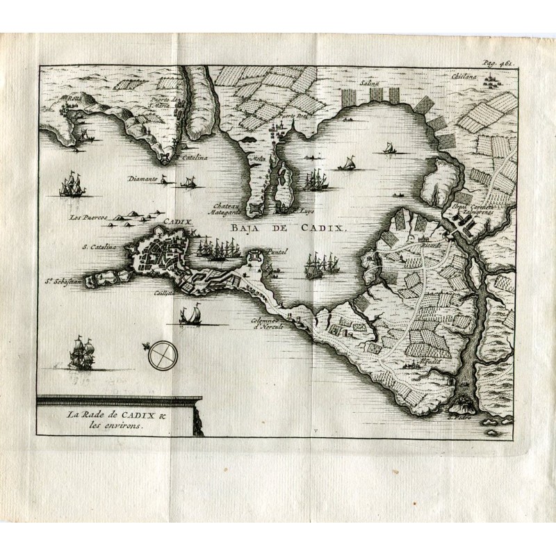


Original 1707 engraved map of the bay of Cadiz and its surroundings, lettered at the foot "La Rade de Cadix & les environs". It shows the walled city, Rota, El Puerto de Santa María, Puerto Real, Chiclana, the castle of Matagorda and El Puntal, with a scale bar and a compass rose.
Original 1707 engraved map of the bay of Cadiz and its surroundings, lettered at the foot "La Rade de Cadix & les environs". It shows the walled city, Rota, El Puerto de Santa María, Puerto Real, Chiclana, the castle of Matagorda and El Puntal, with a scale bar and a compass rose.
From Les Délices de l'Espagne et du Portugal, published at Leiden by Pieter van der Aa in 1707. It is of interest for the detail of the fortifications and the shoals of the bay on the eve of the War of the Spanish Succession, with the fleet at anchor before the city.
Medium: Copper engraving on laid paper.
Engraver / publisher: Pieter van der Aa (Leiden, 1659-1733).
Date: 1707 (first edition).
Source: Les Délices de l'Espagne et du Portugal, Leiden, 1707; p. 461.
Dimensions: Image 4.9 x 6.3 in (12.4 x 16 cm); sheet 6.5 x 7.5 in (16.4 x 19 cm).
Condition: Good; central binding fold and a rust spot in the lower margin.
Original 1707 engraved map of the bay of Cadiz and its surroundings, lettered at the foot "La Rade de Cadix & les environs". It shows the walled city, Rota, El Puerto de Santa María, Puerto Real, Chiclana, the castle of Matagorda and El Puntal, with a scale bar and a compass rose.