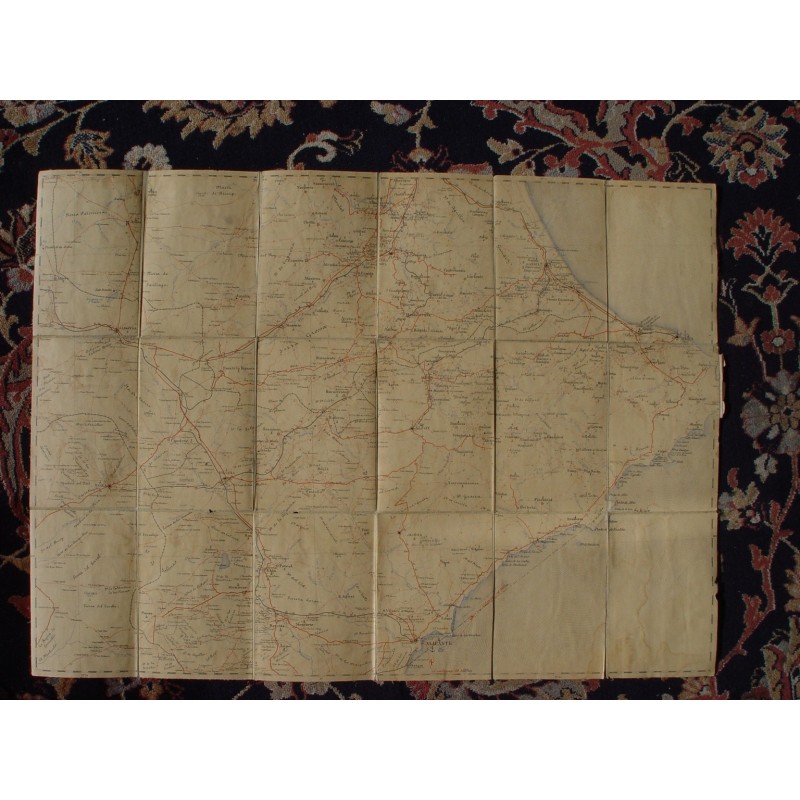


Antique linen-backed map of the province of Alicante, sheet 67 of the Mapa Militar Itinerario de España, at a scale of 1:200,000. Printed in several inks, with the network of tracks and roads in red, and folded in panels onto linen inside its original cloth covers with typographic labels.
Antique linen-backed map of the province of Alicante, sheet 67 of the Mapa Militar Itinerario de España, at a scale of 1:200,000. Printed in several inks, with the network of tracks and roads in red, and folded in panels onto linen inside its original cloth covers with typographic labels.
It runs from the Sierra de Salinas and Villena to the coast, with Alicante, Elche, Denia, Villajoyosa, Novelda and Elda, and the diagram of adjoining sheets (56-58, 66-68, 76-78) on the cover.
Medium: Lithograph / color printing on linen-backed paper.
Date: 1892.
Source: Mapa Militar Itinerario de España, sheet 67 (Alicante). Scale 1:200,000.
Dimensions: Folded 5.9 x 4.3 in (15 x 11 cm); open 18.7 x 26 in (47.5 x 66 cm).
Condition: Fair for its age. Paper toned and with some damp rings; cloth covers rubbed, with small stains and wear to edges and corners.
Antique linen-backed map of the province of Alicante, sheet 67 of the Mapa Militar Itinerario de España, at a scale of 1:200,000. Printed in several inks, with the network of tracks and roads in red, and folded in panels onto linen inside its original cloth covers with typographic labels.