
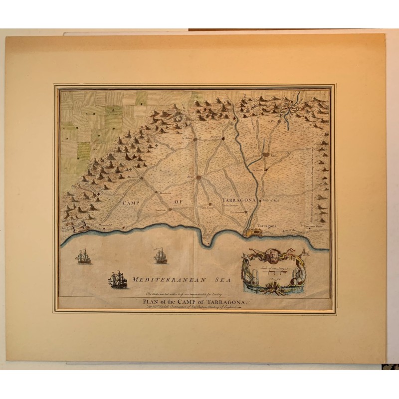


Original mid-18th century engraving with the map of the Camp of Tarragona, between the mouth of the Ebro and the road to Barcelona: walled Tarragona on the sea, Reus, Valls, Cambrils, Montbrió, Constantí, Villaseca and Hospitalet, with the road network and the relief drawn in profile.
Original mid-18th century engraving with the map of the Camp of Tarragona, between the mouth of the Ebro and the road to Barcelona: walled Tarragona on the sea, Reus, Valls, Cambrils, Montbrió, Constantí, Villaseca and Hospitalet, with the road network and the relief drawn in profile.
It was engraved in London for the continuation that Nicholas Tindal wrote of Rapin-Thoyras's History of England, published by the Knaptons between 1744 and 1747 and illustrated with maps of the campaigns of the War of the Spanish Succession. A note warns that the hills marked with a cross are impassable for cavalry; the scale cartouche is signed by Isaac Basire.
Medium: Copper engraving, hand-colored.
Engraver: Isaac Basire.
Date: 1744-1747.
Source: The History of England by Paul de Rapin de Thoyras, continued by Nicholas Tindal; London, John and Paul Knapton.
Dimensions: Image 15.0 x 18.5 in (38 x 47 cm).
Condition: Good. Mounted in a mat; light creases in the lower part of the sheet.
Original mid-18th century engraving with the map of the Camp of Tarragona, between the mouth of the Ebro and the road to Barcelona: walled Tarragona on the sea, Reus, Valls, Cambrils, Montbrió, Constantí, Villaseca and Hospitalet, with the road network and the relief drawn in profile.


