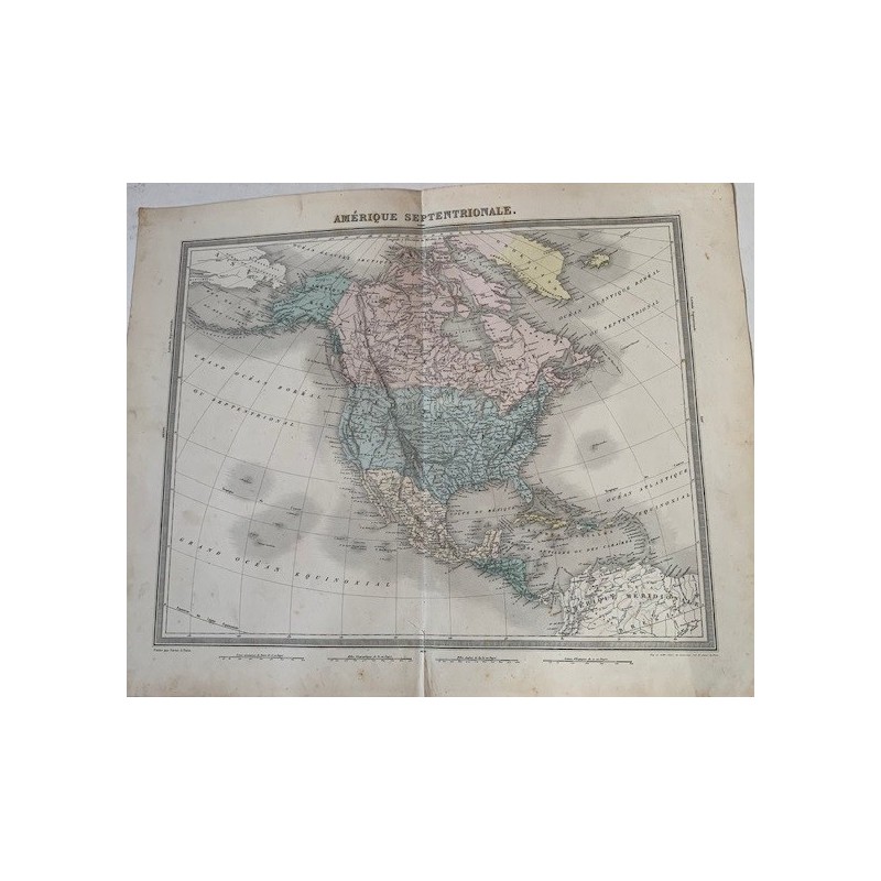

Antique map of North America, engraved in copper and hand-colored in outline, from the Arctic Ocean to the isthmus of Panama, with the West Indies and the great rivers and mountain ranges given in detail. It is an interesting state: Texas already appears within the United States, while the Californias and New Mexico are still in the color of Mexico. Below, "Publie par Furne, a Paris".
Antique map of North America, engraved in copper and hand-colored in outline, from the Arctic Ocean to the isthmus of Panama, with the West Indies and the great rivers and mountain ranges given in detail. It is an interesting state: Texas already appears within the United States, while the Californias and New Mexico are still in the color of Mexico. Below, "Publie par Furne, a Paris".
From the Atlas Universel de Geographie ancienne et moderne by A. Tardieu and A. Vuillemin, published in Paris by Furne to accompany Malte-Brun's Geographie Universelle.
Medium: Copper engraving with hand-colored outline, on wove paper
Cartographers: Ambroise Tardieu and A. Vuillemin
Publisher: Furne, Paris
Date: Mid-19th century
Source: Atlas Universel de Geographie ancienne et moderne
Dimensions: Image 16.9 x 13.4 in (43 x 34 cm); sheet 20.1 x 16.1 in (51 x 41 cm)
Condition: Fair. Paper toned with age and with foxing in the margins; a tear at the lower central edge, restored at the verso, which does not affect the map.
Antique map of North America, engraved in copper and hand-colored in outline, from the Arctic Ocean to the isthmus of Panama, with the West Indies and the great rivers and mountain ranges given in detail. It is an interesting state: Texas already appears within the United States, while the Californias and New Mexico are still in the color of Mexico. Below, "Publie par Furne, a Paris".