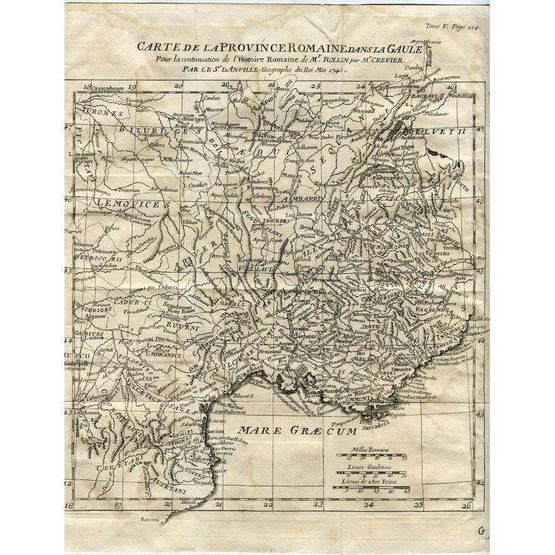


Original engraved map of the Roman Province in Gaul, with the Latin place names of cities, towns and rivers, drawn up by Monsieur D'Anville, geographer to the king, and dated May 1743. It runs from the Pyrenees and Barcino to Helvetia and northern Italy.
Original engraved map of the Roman Province in Gaul, with the Latin place names of cities, towns and rivers, drawn up by Monsieur D'Anville, geographer to the king, and dated May 1743. It runs from the Pyrenees and Barcino to Helvetia and northern Italy.
Medium: Copper engraving on laid paper.
Artist: Jean-Baptiste Bourguignon d'Anville (1697-1782), geographer to the king.
Date: May 1743.
Source: Continuation of the Histoire romaine of M. Rollin by M. Crevier, vol. V, p. 214.
Dimensions: 11 x 8.3 in (28 x 21.2 cm).
Condition: Paper browned with age, with scattered damp stains, a fold and small tears and wear along the edges of the sheet.
Original engraved map of the Roman Province in Gaul, with the Latin place names of cities, towns and rivers, drawn up by Monsieur D'Anville, geographer to the king, and dated May 1743. It runs from the Pyrenees and Barcino to Helvetia and northern Italy.