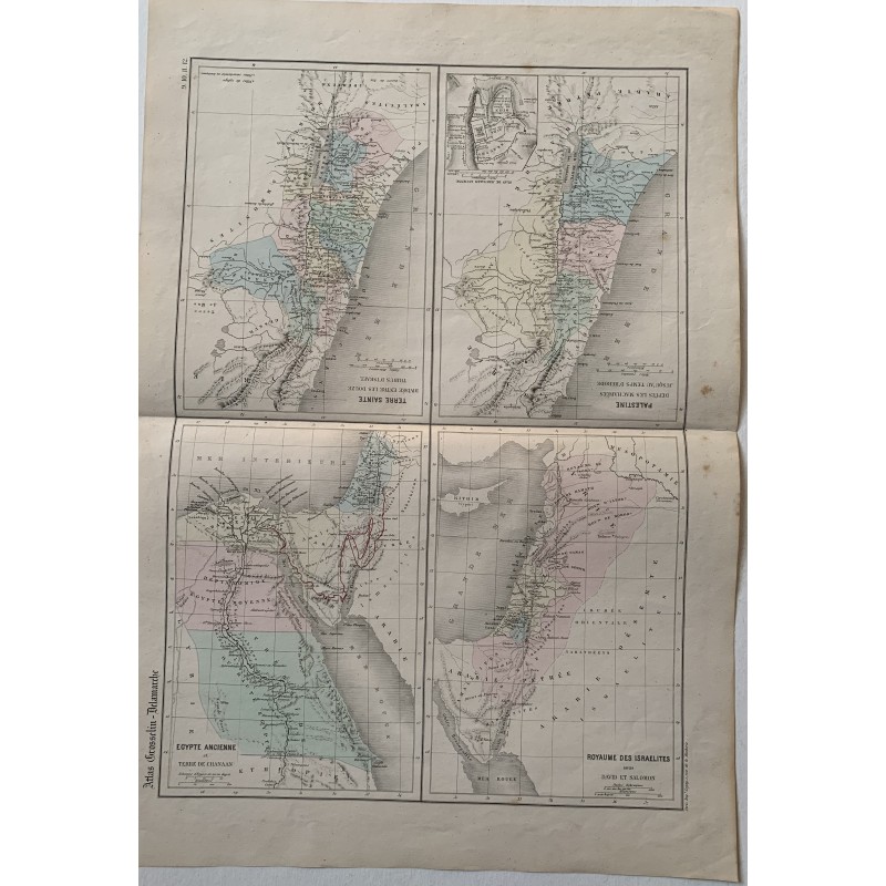


Sheet with four original engraved maps with hand coloring, from the Atlas Grosselin-Delamarche: Terre Sainte divisee entre les douze tribus d'Israel, Palestine depuis les Macchabees jusqu'au temps d'Herode, Egypte ancienne et Terre de Chanaan, and Royaume des Israelites sous David et Salomon.
Sheet with four original engraved maps with hand coloring, from the Atlas Grosselin-Delamarche: Terre Sainte divisee entre les douze tribus d'Israel, Palestine depuis les Macchabees jusqu'au temps d'Herode, Egypte ancienne et Terre de Chanaan, and Royaume des Israelites sous David et Salomon.
The Atlas Grosselin-Delamarche, the work of the geographer Alexandre Delamarche (1815-1884) and the educationalist Augustin Grosselin (1800-1878), was one of the most widely used historical and school atlases in 19th century France. The sheet carries the printed numbering 9, 10, 11 and 12, and a plan of Jerusalem as an inset.
Medium: Copper engraving with hand-colored outlines.
Artist / after: Alexandre Delamarche (1815-1884) and Augustin Grosselin (1800-1878).
Date: 1853.
Source: Atlas Grosselin-Delamarche. Nos. 9-12.
Dimensions: 13.4 x 18.1 in (34 x 46 cm).
Condition: Good. Central horizontal fold from the folding of the atlas, light toning and the odd small spot at the edges; the original color remains fresh.
Sheet with four original engraved maps with hand coloring, from the Atlas Grosselin-Delamarche: Terre Sainte divisee entre les douze tribus d'Israel, Palestine depuis les Macchabees jusqu'au temps d'Herode, Egypte ancienne et Terre de Chanaan, and Royaume des Israelites sous David et Salomon.