

Campaign map of the Spanish Civil War showing the Asturias front and the Cantabrian coast, from Ribadeo to Llanes and inland to the mountains of León. It carries concentric circles 10 km apart for calculating distances, the printed price — Una peseta — and the warning Prohibida la reproducción.
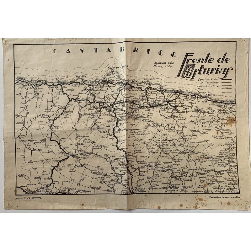
Campaign map of the Spanish Civil War showing the Asturias front and the Cantabrian coast, from Ribadeo to Llanes and inland to the mountains of León. It carries concentric circles 10 km apart for calculating distances, the printed price — Una peseta — and the warning Prohibida la reproducción.
Medium: Printed map.
Date: Spanish Civil War, about 1937-1938.
Dimensions: 17.3 x 11.7 in (44 x 29.8 cm).
Condition: Unfolded sheet, with the folds heavily marked, paper browned, damp stains at the lower right corner and tears at the edges.
Campaign map of the Spanish Civil War showing the Asturias front and the Cantabrian coast, from Ribadeo to Llanes and inland to the mountains of León. It carries concentric circles 10 km apart for calculating distances, the printed price — Una peseta — and the warning Prohibida la reproducción.