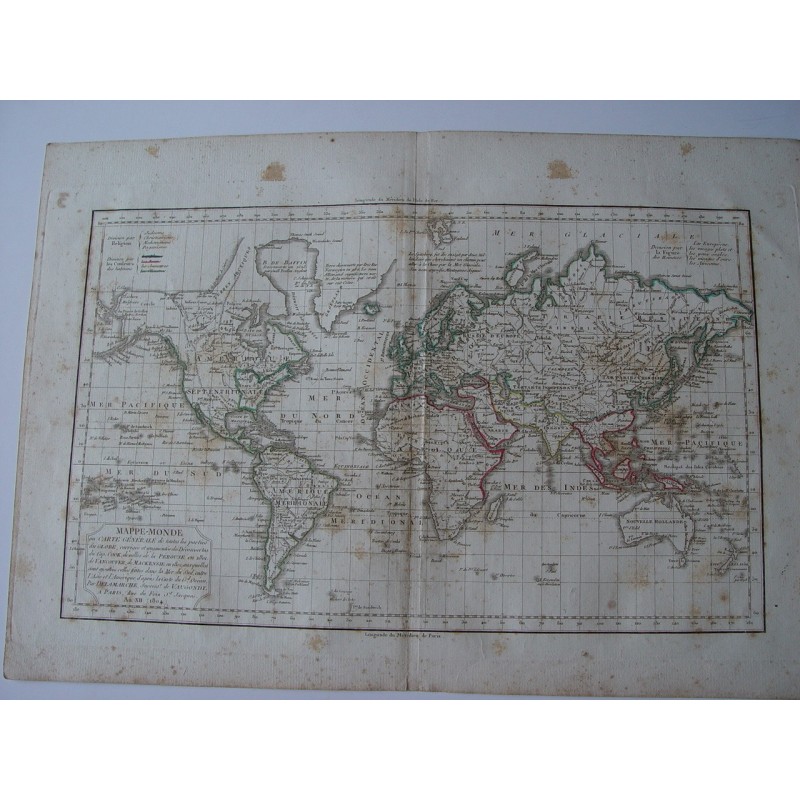


Original world map ("Mappe-Monde ou Carte Générale de toutes les parties du Globe"), engraved on copper with hand-coloured outlines, from the work of Robert de Vaugondy. According to the cartouche, it was corrected and enlarged with the discoveries of Captain Cook, those of La Pérouse in 1801 and of Vancouver and Mackenzie in 1802, together with those made in the South Sea between Asia and America after the chart of the Great Ocean, by Delamarche, Vaugondy's successor, in Paris, rue du Foin Saint-Jacques, in Year XII (1804). It includes explanatory tables dividing the world by religion, by the colour of its inhabitants and by the "figure of men", very characteristic of the geography of the period.
Gilles and Didier Robert de Vaugondy, father and son, were renowned eighteenth-century cartographers, descendants of the cartographer Nicolas Sanson, from whom they inherited much of their cartographic material. In 1757 they published their most famous work, the Atlas Universel, and in 1760 Didier Robert de Vaugondy was appointed geographer to Louis XV. Their successor Charles-François Delamarche later revised and enlarged the plates with the new discoveries.
Medium: Copper engraving (intaglio) on paper, with hand-coloured outlines.
Artist / after: Robert de Vaugondy; corrected and enlarged by C.F. Delamarche, his successor.
Date: Year XII (1804), as stated in the cartouche.
Source: Paris, rue du Foin Saint-Jacques.
Dimensions: Plate 10.6 x 17.4 in (26.8 x 44.1 cm); sheet 12.5 x 17.7 in (31.8 x 45 cm).
Condition: Age-related foxing, heavier in the upper margin, and scattered spotting on the map (Asia, Indian and Pacific Oceans); original central fold; wide margins.