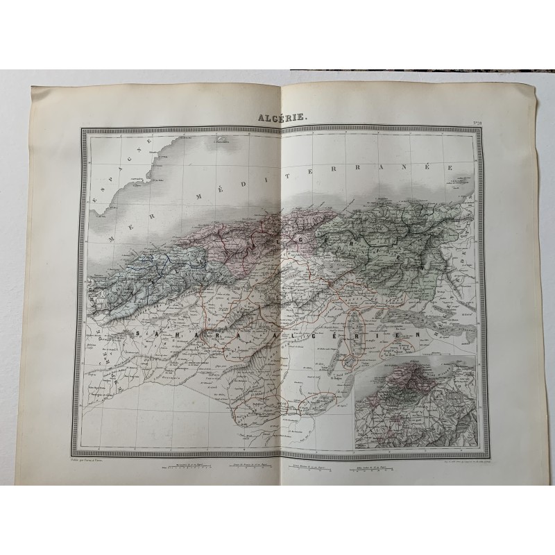


Original map of Algeria engraved in intaglio and hand-colored in outline, titled "Algérie" and numbered 28, with a supplementary inset at the lower right. Engraved by Tardieu, revised and corrected by Alexandre Vuillemin and published at Paris by Furne in 1858.
Original map of Algeria engraved in intaglio and hand-colored in outline, titled "Algérie" and numbered 28, with a supplementary inset at the lower right. Engraved by Tardieu, revised and corrected by Alexandre Vuillemin and published at Paris by Furne in 1858.
It shows French Algeria divided into the three provinces of Oran, Algiers and Constantine, with minute detail of the Tell and the Algerian Sahara and its oases, at the height of colonial expansion.
Medium: Copper engraving, hand-colored in outline.
Artist / after: Alexandre Vuillemin (1812-1880), revision and correction.
Engraver / lithographer: Ambroise Tardieu.
Date: 1858.
Source: Published by Furne, Paris.
Dimensions: 20.9 x 16.9 in (53 x 43 cm).
Condition: Good. Central binding fold as usual for the atlas and light wrinkling and toning in the margins.
Original map of Algeria engraved in intaglio and hand-colored in outline, titled "Algérie" and numbered 28, with a supplementary inset at the lower right. Engraved by Tardieu, revised and corrected by Alexandre Vuillemin and published at Paris by Furne in 1858.