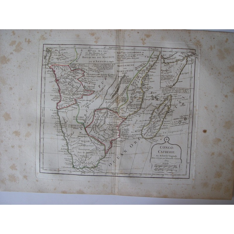


Original map of Congo and Kaffraria ("Congo, Cafrerie"), that is, southern Africa with Madagascar, engraved on copper with hand-coloured outlines, from the work of Robert de Vaugondy. According to the cartouche, it was revised and corrected by Delamarche, his successor, in 1804. Signed lower right by the engraver E. Dussy. It includes an inset of the Horn of Africa and curious notes on the little-known inland kingdoms.
Gilles and Didier Robert de Vaugondy, father and son, were renowned eighteenth-century cartographers, descendants of the cartographer Nicolas Sanson, from whom they inherited much of their cartographic material. In 1757 they published their most famous work, the Atlas Universel, and in 1760 Didier Robert de Vaugondy was appointed geographer to Louis XV. Their successor Delamarche later revised and corrected the plates.
Medium: Copper engraving (intaglio) on paper, with hand-coloured outlines.
Artist / after: Robert de Vaugondy; revised and corrected by Delamarche, his successor.
Engraver: E. Dussy (signed in the plate, lower right: "Gravé par E. Dussy").
Date: 1804, as stated in the cartouche.
Dimensions: Plate 10 x 9.4 in (25.4 x 24 cm); sheet 12.5 x 17.7 in (31.8 x 45 cm).
Condition: Moderate foxing in the margins, light toning at the central fold and a few small spots on the map; wide margins.