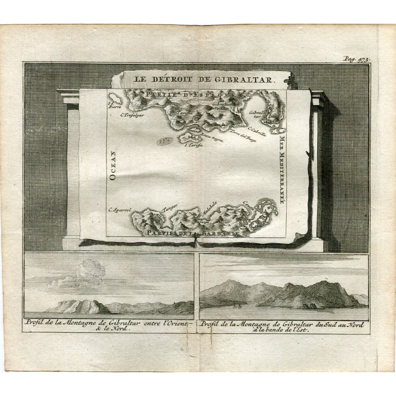

Original 1707 engraved map of the Strait of Gibraltar, with the coasts of Spain and of Barbary — Trafalgar, Tarifa, Ceuta, Tangier — set out like a canvas on an architectural pedestal. Below the map, two profiles of the Rock of Gibraltar taken from different bearings.
Original 1707 engraved map of the Strait of Gibraltar, with the coasts of Spain and of Barbary — Trafalgar, Tarifa, Ceuta, Tangier — set out like a canvas on an architectural pedestal. Below the map, two profiles of the Rock of Gibraltar taken from different bearings.
It comes from Les délices de l'Espagne et du Portugal, by Pieter van der Aa, published in Leiden (Holland) in 1707 (first edition) and attributed to Juan Álvarez de Colmenar.
Medium: Copper engraving.
Engraver: Pieter van der Aa (Leiden, 1659-1733), publisher of the work.
Date: 1707.
Source: Les délices de l'Espagne et du Portugal, Leiden, 1707.
Dimensions: Plate mark 4.9 x 6.3 in (12.4 x 16 cm); sheet 6.2 x 7.2 in (15.8 x 18.4 cm).
Condition: Good condition; a light central fold from the binding, natural to a book leaf.
Original 1707 engraved map of the Strait of Gibraltar, with the coasts of Spain and of Barbary — Trafalgar, Tarifa, Ceuta, Tangier — set out like a canvas on an architectural pedestal. Below the map, two profiles of the Rock of Gibraltar taken from different bearings.