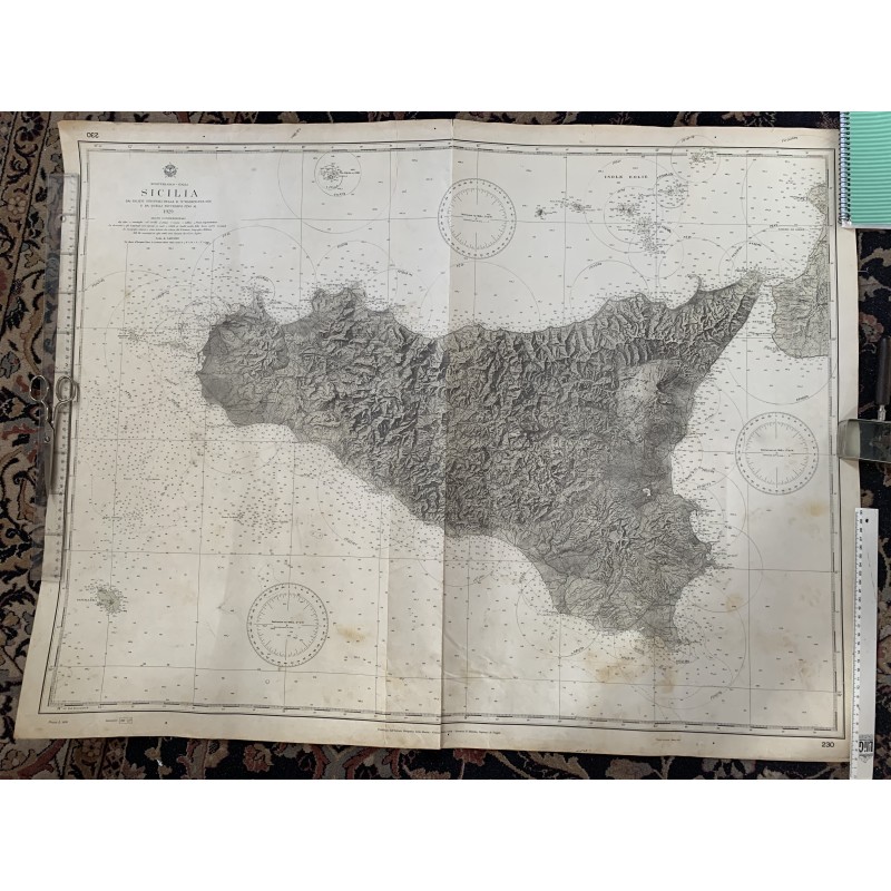


Historic nautical chart of Sicily published by the Istituto Idrografico della Marina in Genoa, titled "Mediterraneo - Italia. SICILIA" and corrected up to 1929, with chart number 230 in the corners. It shows the whole island with shaded relief, the Aeolian Islands, Ustica, the Egadi Islands and Pantelleria, the Strait of Messina and the tip of Calabria, with thousands of soundings, lighthouse ranges marked by circles and four compass roses with magnetic variation.
According to its title, it was compiled from the original hydrographic surveys and later ones up to 1929. A large, very decorative piece, ideal for framing in a maritime setting or for collectors of Sicilian cartography.
Medium: Nautical chart printed in black.
Artist / after: Istituto Idrografico della Marina, Genoa.
Date: 1929.
Source: Istituto Idrografico della Marina, Genoa (chart No. 230).
Dimensions: 39.4 x 31.5 in (100 x 80 cm).
Condition: Good overall condition. Central vertical join, damp stains in the lower part, mainly near the south coast, small tears and wear at the edges; notes and a stamp on the back. Stored rolled, so it may need flattening.