

Colored lithographed map of the United States, with the relief, the railway network, the states and their capitals, and the explanatory note on the District of Columbia. Printed at the Litografía Fernández, calle Gonzalo de Córdoba 17, Madrid.
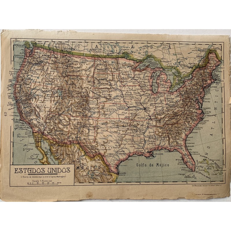
Colored lithographed map of the United States, with the relief, the railway network, the states and their capitals, and the explanatory note on the District of Columbia. Printed at the Litografía Fernández, calle Gonzalo de Córdoba 17, Madrid.
Medium: Colored lithograph.
Printer: Lit. Fernández, Gonzalo de Córdoba 17, Madrid.
Scale: 1:15,000,000.
Dimensions: 13.2 x 9.6 in (33.5 x 24.5 cm).
Condition: The map complete and legible; the paper shows yellowing, tears and losses in the margins from handling, above all at the lower and right edges.
Colored lithographed map of the United States, with the relief, the railway network, the states and their capitals, and the explanatory note on the District of Columbia. Printed at the Litografía Fernández, calle Gonzalo de Córdoba 17, Madrid.