- New
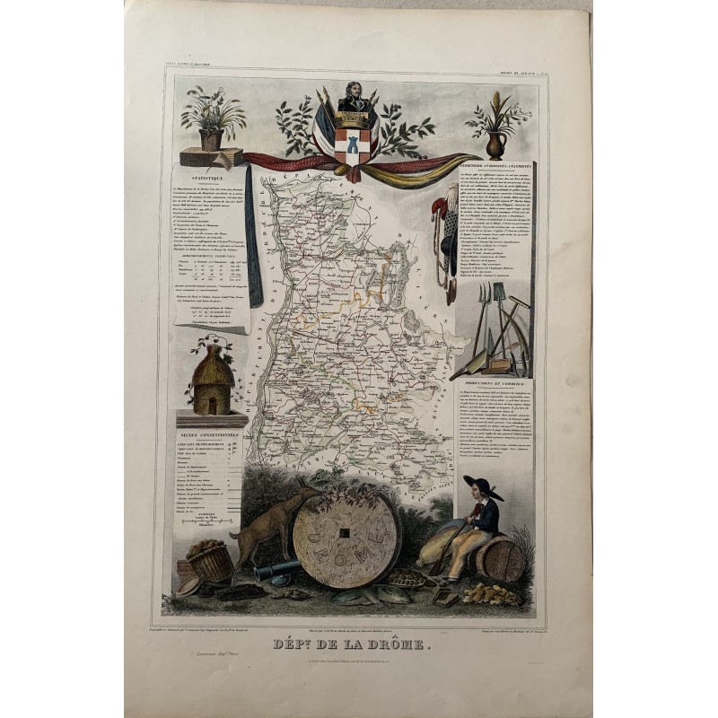


Antique map of the French department of the Drôme, engraved and hand-colored, with decorative borders: the portrait of Marshal de Villars above the departmental arms, tables of statistics and produce, and at the foot an allegorical scene with the cheese, the truffle and the wine of the region.
It comes from the "Atlas National de la France Illustré" of Victor Levasseur (1800-1870), one of the most sought-after French atlases of the 19th century precisely for these engraved borders. The cartography is by Levasseur, the borders were engraved by Laguillermie and Rainaud, and the printing is by the house of Lemercier in Paris.
Medium: Steel engraving, hand-colored.
Artist / after: Victor Levasseur.
Engraver / lithographer: Laguillermie and Rainaud; printed by Lemercier, Paris.
Date: About 1852.
Source: "Atlas National de la France Illustré", Paris.
Dimensions: 14.2 x 21.3 in (36 x 54 cm).
Condition: Good. Original color well preserved; light toning of the paper and small foxing spots in the margins.