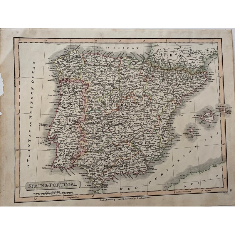


Original map of Spain and Portugal, engraved on copper and hand-colored in outline, published in London by C. Smith in 1816. It covers the kingdoms and provinces of the peninsula, the Balearic Islands and North Africa, with the scale in English miles and the Greenwich meridian.
Original map of Spain and Portugal, engraved on copper and hand-colored in outline, published in London by C. Smith in 1816. It covers the kingdoms and provinces of the peninsula, the Balearic Islands and North Africa, with the scale in English miles and the Greenwich meridian.
Medium: Copper engraving, hand-colored
Date: 1816
Source: Published in London by C. Smith, Mapseller, no. 172 Strand, 1 January 1816
Dimensions: 15.4 x 11.8 in (39 x 30 cm)
Condition: Period coloring well preserved; foxing and a small loss in the left margin, outside the engraved area.
Data sheet
Original map of Spain and Portugal, engraved on copper and hand-colored in outline, published in London by C. Smith in 1816. It covers the kingdoms and provinces of the peninsula, the Balearic Islands and North Africa, with the scale in English miles and the Greenwich meridian.