- New
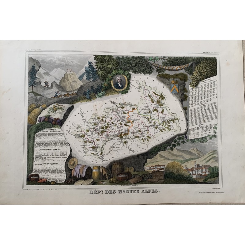


Antique map of the "Dept. des Hautes Alpes" engraved by Victor Levasseur and hand-colored in the mid-19th century. The central map is framed by allegorical borders drawn by Raymond Bonheur: hunters and mountain folk, the produce of the region, cheeses and sausages, and a town view below.
It comes from the Atlas National Illustre, published in Paris by Combette. The borders by Raymond Bonheur, father of the painter Rosa Bonheur, are what set this collection apart from any other French departmental atlas of the period.
Medium: Hand-colored copper engraving.
Artist / after: Raymond Bonheur (borders).
Engraver / lithographer: Victor Levasseur.
Date: Mid-19th century.
Source: Atlas National Illustre, Combette editeur, Paris.
Dimensions: 21.3 x 14.6 in (54 x 37 cm).
Condition: Good; paper somewhat toned, with light staining and wear in the margins.