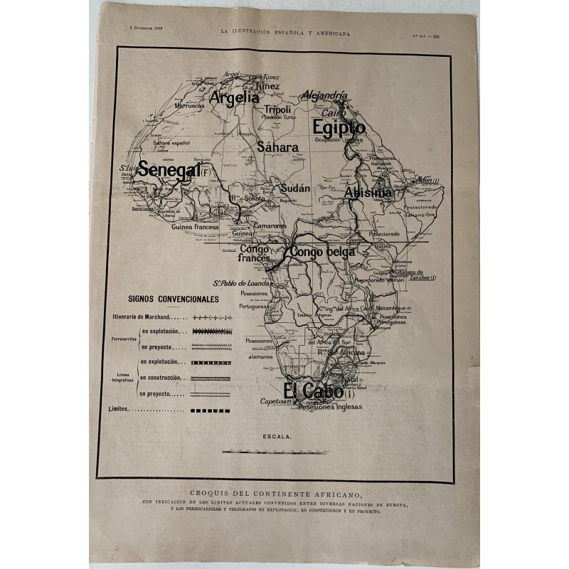

Sketch map of the African continent published in La Ilustración Española y Americana on 8 December 1898, showing the boundaries then agreed between the European nations and the railways and telegraph lines in service, under construction and projected. It includes the itinerary of Marchand, who that same year was at the center of the Fashoda incident.
Sketch map of the African continent published in La Ilustración Española y Americana on 8 December 1898, showing the boundaries then agreed between the European nations and the railways and telegraph lines in service, under construction and projected. It includes the itinerary of Marchand, who that same year was at the center of the Fashoda incident.
Medium: Illustrated press print
Date: 8 December 1898
Source: La Ilustración Española y Americana, no. XLV, with text on the reverse
Dimensions: 11.2 x 15.7 in (28.5 x 40 cm)
Condition: Paper toned as usual for period newsprint, with somewhat worn edges; the map complete and clearly legible
Sketch map of the African continent published in La Ilustración Española y Americana on 8 December 1898, showing the boundaries then agreed between the European nations and the railways and telegraph lines in service, under construction and projected. It includes the itinerary of Marchand, who that same year was at the center of the Fashoda incident.